Check out the
West Desert ATV Trails
This area is very remote – there are no services between Delta and the Utah/Nevada state line. The area is also very dry,. Please carry extra water, food and fuel, plan for more than you think you will need, plus extra just incase. Carry an extra spare tire, tools and emergency equipment.
Spring and fall months provide the best riding weather. Summers can be very hot but it is still pleasant to ride early and late in the day. Winter nights are cold but days are often mild and riding can be enjoyable.
Also try using the GPS app Avenza Maps. It has all 4 trail systems to download for free. There is often no cell service. Use GPS and be prepared with emergency equipment and everyday essentials, especially water. Always tell someone where you are going.
Amasa Basin
provides approximately 33 miles of trails ranging from easy to very difficult. The trailhead is in Miller Canyon but you can access the trail from North Canyon.
The Cricket Mountains
provide approximately 129 miles of trails ranging from easy to difficult. Trailheads are located at Johnson Pass, Little Sage Valley, Cedar Pass and Headlight Canyon.
Conger Mountain
provides 127 miles of trails, ranging from easy to difficult. Trailheads are located at Little Valley Well and Kings Canyon.
Burbank Hills
provide about 98 miles of trails, ranging from easy to difficult. Trailheads are at Cedar Pass and Red Pass on the east side and Pruess Lake and Mormon Gap Reservoir on the west side.
Join us!
National ATV Jamboree
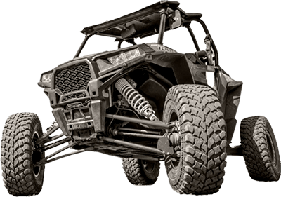
We have a whole event centered around exploring our unique Millard County ATV/UTV trails! Running since 1987, the National ATV Jamboree is the longest running ATV event in the United States and is famous among ATV enthusiasts.
Also try using the GPS app Avenza Maps. It has all 4 trail systems to download for free. There is often no cell service. Use GPS and be prepared with emergency equipment and everyday essentials, especially water. Always tell someone where you are going.


Exploring
The Paiute ATV Trail
Central Utah’s 275-mile long Paiute ATV Trail, part of which falls in Millard County, is a loop trail with no beginning and no end! It passes through several towns and has side trails leading to others. Dirt Wheels magazine rates the Paiute ATV Trail as one of the 15 best trails in the country. It has been rated as one of the top five trails in the country by ATV Illustrated magazine. Many riders consider the Paiute Trail to be the top in the United States.
The trail is designed to provide an enjoyable recreational ride through fantastic scenery. The trail was formed by connecting old roads and trails through Fishlake National Forest and BLM managed land. Several narrow sections of trail were eventually constructed to complete the loop. The main trail is 275 miles long, with over 1000 miles of marked side trails and over 1500 estimated miles of side forest roads and trails. Due to its vast size, the Paiute ATV Trail is best explored in segments.
The Paiute ATV Trail caters to relaxing and family type riding. Many riders along the four-foot wide trails enjoy the scenery and atmosphere of a deeply dense forest, as well as popular activities such as fishing or camping near the path. Panoramic scenes along ridges allow riders to see over 100 miles in the distance (and 11,000 below!), which makes the ATV trail a popular photographic destination. Wildlife is commonly spotted close by, including occasional glimpses of free-roaming herds of deer and elk.
The main loop of the trail takes approximately 25 riding hours to complete, but that doesn’t leave much time for stopping or taking pictures. For comfort and full enjoyment of the trail, the time should be spread out over three to four days. However, riders choosing to explore the thousands of miles of marked and unmarked side forest roads and trails may find themselves riding for weeks.
Get the most out of your ride
The Riding Season
Spring through fall offers riding opportunities, though each season brings its own experiences and adventures. While spring riding is possible on the lower portions of the trail, snowdrifts can close the trail over the Pahvant Mountains and the Sevier Plateau until mid-to-late July. There is an ATV/UTV Jamboree in June that is perfect weather. September and October provide some of the best riding weather on the Paiute Trail. At this time of year the days are brisk, the nights cool, the trees colorful and the chance of precipitation is low. August also a good time for the high country, although the lower portions of the trail can be hot. After October, storms may close the upper portions of the trail or make riding slightly unpleasant, but not unbearable.
Conact for more information
Know before you go
Millard County Tourism
435-743-7803
435-979-0950
Fishlake National Forest
Fillmore Field Office
390 South Main
Fillmore, Utah 84631
435-743-5721
BLM Field Office
95 East 500 North
Fillmore, Ut, 8463
435-743-3100


